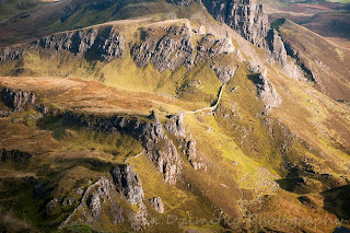
tego poranka udalo nam sie zobaczyc quiraing w chmurze, we mgle, w sloncu I w nawet nieco w deszczu. a wszystko to na przestrzeni zaledwie 3 godzin!
punkten startowym odwiedzin quiraing jest (stosunkowo duzy) parking znajdujacy sie przy malej, jednopasmowej drodze laczacej staffin z uig. droge ta latwo jest znalezc - w staffin jest oznaczenie na quiraing. od glownej drogi jedzie sie moze 5 minut (od strony staffin) trzeba podjechac az do wysokosci wierzcholka klofow, droga wije sie stromo w gore, ale na bardzo krotkim odcinku.
z parking nalezy wziac sciezke oznaczona jako szlak na flodigarry.
prawde mowiac sa 2 opcje zwiedzenia quiraing. pierwsza z nich to po prostu spacer od razu do tych charakterystycznych form skalnych (pod klifem) I powrot ta sama droga. ta opcja moze zabierac od 1.5-2 godzin.
inna opcja, to wejscie na klify I najpierw zobaczenie quiraing z gory a potem zejscie I spacer wsrod skalnych form. my oczywiscie wybralysmy wlasnie te opcje.
tak wiec z parkingu nalezy isc w kierunku flodigarry, od tej glownej sciezki prawie natychmiast odbija miej wyrazna, idaca prosto pod gore (widac gdzie trawa jest wydeptana I gdzie nalezy sie kierowac. tak wiec najpierw krotki stromy odcinek ktory dolacza do porzadnej sciezki idacej wzdloz krawedzi klifu. spontanicznie zdecydowalysmy sie na ta wlasnie klifiasta sciezke, chodz kiedy przyjechalysmy szczyt klifu byl szczelnie przykryty chmurami. udalo nam sie jednak cos zobaczyc, jako ze chmury przelatywaly pedzone wiatrem czasem bylo cos widac przez chwile zanim nie nawialo nowych. musze przyznac ze taka chmurzasta, kaprysna aura tez miala swoj klimat I klify zdawaly sie jak z bajki. szybko dotarlysmy do szczytu quiraing, potem jeszcze szybciej zeszlysmy do doliny, pod klify. sama sciezka I zejscie z klifow na dol nie jest zbyt stroma, samo przekroczenie granicy klifu jest latwe I stromo w dol schodzi sie moze jedynie 20 metrow, latwiej niz sie obawialam sadzac po roznicy wysokosci.
pod klifami jest gesta siec sciezek prowadzacych w rozne zakatki quiraing, warto sie powalesac.
w sumie jest tylko jedna glowna sciezka, nie sposob nie trafic spowrotem na parking.
musze wspomniec ze w drodze powrotnej jest jedno dosc dziwne przejscie przez strumien (gdzie trzeba po sliskiej skale zejsc w szczeline a potem wejsc w gore po drugiej stronie. latem nie na problem, ale Zima moze byc nieco trudniej.
czas przejscia 3 godz
.
.
.
.
that morning we managed to see quiraing in the clouds, mist, rain and sunshine.. and all this within only 3 hrs!
starting point for quiraing visit is a car park located along the minor road going between staffin and uig. when driving from staffin it's easy to find -there is a signpost for quiraing. it's about 5 mins drive from the main road, and you cant miss it. the single track road will take you steeply up to the cliffs height (thanks goodness it's not a busy road!) and just at the top -there is a reasonably large car park.
from the car park, take the path signposted for flodigarry.
generally, there are 2 ways of seeing quiraing. easy one -from the car park follow the flodigarry path directly to the weird rock formations and come back the same way. this will take between 1.5 - 2hrs.
there also is other way to see it -more difficult (but not much) as it involves going to the summit of quiraing.
this was what we decided to do. from the car park, still take the flodigarry path but very soon turn left and climb up the hill. at first there isn't any well defined path only grassy slope but you will be able to see where people walked. soon enough you will join a well defined path going along the cliff's edge. follow it.
during our visit, the summit was well covered by clouds and at first we did regret taking this route. but then we realised that this dance of clouds and light brought some kind of magical atmosphere. and after all we managed to see something from the top too :)
we reached the summit rather quickly, then walked down to the pass. I imagined it will be a gully of some sort that would lead us steeply back to the glen. fortunately, the path led us gently down and when we reached the edge of cliff it became steep, of course, but not for long, maybe 20 metres only. at the end of the day going down was much easier and pleasant than I anticipated.
there is one main path going underneath the impressive cliffs and dozen of smaller ones taking you to the hidden corners and rock needles. take time to explore :)
the main path goes back to the car park, the only thing I wanted to mention is a stream crossing. at one point there is one, rather awkward. summertime -no problem but in winter it might be icy and wee bit of a challenge.
our total time 3 hrs
trasa dnia / route of the day
map copyright ordnance survey
krety stromy podjazd na wysokosc klifow / steep winding road to the cliffs edge
quiraing z parkingu / from the car park
konflikt pomiedzy chmurami I sloncem / conflict between the sun and clouds coming down
szczyt quiraing szczelnie zakryty chmura / quiraing summit hiding in clouds
... ale wciaz bylo cos widac! / but still we managed to see something!
quiraing szczyt / summit
nawet dosc magiczna atmosfera.. I ta cisza....
kind of magical atmosphere.. and the silence....
slonce! / sunshine!
gdzie konczy sie woda a zaczyna niebo..? / where the sea ends and sky begins....
w dolince pod klifami / below the cliffs already
..a za gorka- deszcz! / and what? rain comes back!
ostatnie spojrzenia I w droge do domu! / last glimpse and off we go...home :(


No comments:
Post a Comment