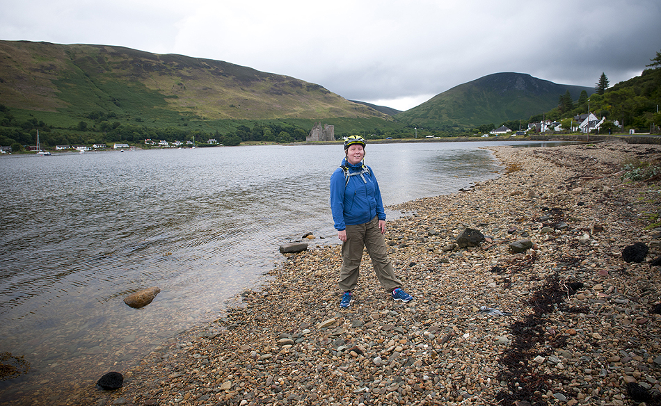
our first visit to isle of arran
finally, after years and years of talking about it, 2 failed attempts (due to weather/ferry disruptions etc) we set out feet in brodick. and what was the reason for going to arran? cycling! bikes, oh bikes, our new bikes made us go there :) but apart from cycling we still had time for other activities
goatfell is the highest mountain on arran, 874m (only??!! some would say), but taking into account that climb starts at sea level, gained height is just the same as when climbing munros. so dont let it fool you, climbing goatfell is still a hard work and effort. well worth it, may i add :)
there are a couple of paths leading to goatfell, from brodick and corrie. we opted for more adventurous option - from corrie. getting to the car park was an adventure in itself - when we turned from the main road (there is a little signpost 'path to goatfell') we faced a tiny (and i do mean it - tiny wee, hardly drivable) road. for those who are not kamikazee, or maybe not familiar with mountain roads or just feel uncomfortable driving a narrow single track road with no passing places, and no passing options really as road is lined with shrubs, wall, fence... (i prayed to god that nobody drives opposite direction while i climb up).. i got carried away i see, so if somebody is not comfortable with a thought driving there, please leave the car at the main road - it's only 1 mile from main road to the car park, easily walkable.
when we finally arrived at the car park i was sooooo relieved! we quickly took our stuff and began to walk. there is a clear path all the way up, at first it goes thru woodland, then crosses the fence (gate) and enters an open moorland....
.
.
to nasza pierwsza wizyta na wyspie arran
w koncu udalo nam sie tam dotrzec - po kilku latach planowania i nawet kilku 'juz tuz tuz' kiedy nie powiodlo sie z powodu pogody czy problemow z promami.. no w koncu nasze nogi postaly w brodick. och, a jaki w koncu nas powod zainspirowal by jechac na arran? rowery! rowery, nasze nowe rowery nam kazaly :) no, ale poza faktem ze arran jest mekka rowerzystow, jest tam jeszcze wiele innych rzeczy do roboty :)
goatfell jest najwyzszym szczytem arranu, 874m (ktos powiedzialby ze TYLKO), ale biorac pod uwage ze wejscie na goatfell zaczyna sie od poziomu morza , to jednak mozna sie umeczyc zdobywajac cala ta wysokosc. niech was nie zwiedzie mysl ze to tylko mala gorka, wciaz mozna sie nasapac!
na goatfell prowadzi kilka sciezek, zaczynaja sie brodick, corrie, z corrie sciezka jest nieco trudniejsza i dluzsza wiec postanowilysmy sprawdzic wlasnie ja. juz sam wjazd do parkingu skad zaczyna sie szlak jest 'przygoda'. w momencie kiedy skrecilysmy z glownej drogi (jest znak) okazalo sie ze przed nami jest malutenka, maciupka drozka. jesli nie jest sie kamikazee albo nie jest sie zaprawionym kierowca doswiadczonym na gorskich drogach, albo jesli ktos po prostu nie czuje sie komfortowo na waskiej jednopasmoweczce bez miejsc do omijania, a cala droga jest ciasno otulona albo krzakami, murkiem czy plotem... (jak ja sie modlilam zeby nikt nie nadjechal z przeciwnego kierunku kiedy jechalysmy pod gore) .. widze ze mnie troszke ponioslo.. w kazdym razie jesli ktos czuje sie niekomfortowo w takich warunkach polecam zostawic samochod przy glownej drodze - stamtad do parkingu jest tylko 1.5 km
kiedy w koncu dojechalysmy do parkingu poczulam taaaaka ulge! szybko zabralysmy co trzeba i zaczelysmy nasz maly trek. sciezka jest porzadna, dobrze widoczna, najpierw wiedzie przez lasek, a potem przechodzimy bramke i nagle jestesmy na wielkiej otwartej przestrzeni wrzosowiska...
route of the day. blue-marked is the nasty road up, it may be better to leave car at the main road
trasa dnia, na niebiesko zaznaczylam ta paskudna droge, mozna zostawic samochod przy glownej szosie
map copyright ordnance survey
here it is, past the gate, open moorland. path is very well made and easy to follow..
prosze bardzo, za bramka zaczyna sie wrzosowisko. jak widac, sciezka jest naprawde porzadna..
yeah, nice path but seems to be going on and on forever...and it took ages to finally reach the bealach between mullach buidhe and north goatfell. but we managed :)
taa, sciezka fajna, ale wydawalo nam sie ze idziemy cale wieki i zanim dotarlsmy do przeleczy pomiedzy mullach buidhe i north goatfell bylysmy juz nieco sfrustrowane
view from the bealach / widok z przeleczy
the saddle & cir mhor
our path continues along the ridge, towards north goatfell
sciezka biegnie przy klifie, az do north goatfell
@ bealach / przy przeleczy
coire lan
mullach buidhe
the saddle
cir mhor
as soon as we reached the bealach we were hit by high winds
strasznie wialo na grani
@ stacach
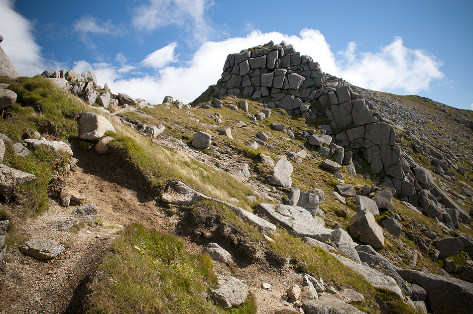
goatfell ridge is very rocky and rugged. we tried to head straight on, but with such strong wind it was really dangerous. we turned back and headed down to the bypass path
gran goatfell jest bardzo skalista. probowalysmy ja przejsc idac po samym 'ostrzu', ale przy takim wietrze bylo to po prostu niebezpieczne. zawrocilysmy i zeszlysmy nieco nizej, na sciezke ktora omija trudnosci i jest oslonieta
ferry from ardrossan to brodick
prom z ardrossan do brodick
north goatfell
the ridge / gran
north goatfell
almost there! prawie jestesmy!
goatfell
summit / szczyt
nice big slabs, amazing views around..
fajne, ogromne glazy, niesamowite widoki
on the roof of arran! / na dachu wyspy arran!
view from the summit towards brodick
widok ze szczytu w strone brodick
path down from the summit was a bit challenging at times, scree and loose rocks, but soon we reached the fork (one leg going to brodick, the other to corrie)
from there it was again easy to follow down and took us back to the car park