
zaczynam myslec ze to jakas niepisana tradycja ze co roku w listopadzie jade sama w gory, co roku listopadowa wyprawa jest bardzo udana.. moznaby nawet powiedziec ze listopadowy wypad zawsze zaliczam do najlepszych danego roku.. tym razem wybralam sie do lake district, na helvellyn.
coprawda planowalam wypad do assynt ale szkocja zostala zaatakowana przez wietrzna I sniezna zime, tak wiec musialam szukac alternatywy. lake district, a zwlaszcza helvellyn byl swietnym pomyslem.
ruszylam z edynburga zaraz po 6.00 I dopiero kiedy dojezdzalam do autostrady M74 zaczelo robic sie jasno. nie wspomne ze w Scottish borders temteratura spadla az do -7.5 stopnia co dosc mocno mnie zaskoczylo, ale rzeczywiscie wszystko bylo porzadnie oszronione.
wieczorem przez wyjazdem sprawdzilam kamerki internetowe w lake district by upewnic sie jakie sa warunki w gorach I czy musze brac ze soba raki I czekan. jako ze gory wygladaly na 'czyste' caly sprzet zimowy zostal w domu. jakie bylo moje zaskoczenie kiedy po zjezdzie z M6 po raz pierwszy tego dnia zobaczylam szczyty lake district.. byly bialutkie...
przez chwile sie nawewt zastanawialam czy nie zamienic planow I nie isc najpierw na skiddaw, ktory bylby latwiejszy w takich warunkach I miec nadzieje ze nastepnego dnia sniegu na helvellyn bedzie nieco mniej. nie pasowalo mi to jednak zbytnio wiec kontynuowalam jazde do glenridding.
planowalam zaczac szlak z mniej uczeszczanego miejsca, zaraz za glenridding, ale niestety 'na zywo' nie udalo mi sie go zlokalizowac, tak wiec zawrocilam do glenridding, zaparkowalam kolo visitor centre I stamtad szlam na helvellyn.
w sumie cala droge, az do samej striding edge zastanawialam sie czy to dobry pomysl zebym w takich warunkach szla po waskiej I stromej grani bez zadnego zimowego osprzetu. postanowilam jednak isc I zobaczyc jak jest I ewentualnie zawrocic I isc inna droga...
helvellyn 950mnpm
trasa:
glenridding -birkhouse moor-striding edge- helvellyn szczyt -swirral edge -birkhouse moor -glenridding.
czas przejscia niecale 6 godz
.
.
.
.
I actually started wondering whether my 'all by myself' November trips are kind of a tradition...? apparently every year, in November I go to the mountains all by myself and what is more -the trip always is a highlight of the hillwalking year. this time I drove down to lake district, to tackle helvellyn.
to be honest my plans were more concentrated on going to assynt but as Scotland was hit by brutal winter weather I decided against it. at the end of the day a choice of lake district, especially helvellyn was a very good one, incredibly amazing!
I left Edinburgh just after 6am and only when I reached the M74 it was getting brighter. not to mention that Scottish borders were properly frozen (-7.5degree!!!!)
the evening before my trip I checked webcams located in Keswick area to make sure I was aware and ready for the mountain conditions in lake district. as the mountains looked 'all clear' I left all my winter gear at home (crampons and ice axe). you can imagine my confussion when I left M6 and had a first glimpse of the Lake district mountains.... all summits nice and white!
for a moment I considered swapping helvellyn for skiddaw (which I planned for next day) as I knew skiddaw would be easier to climb in snow.. but wasn't really sure if I could hope for better conditions next day .. and I really wanted to climb helvellyn.
therefore I continued driving to glenridding.
I planned to start the walk from less popular spot just pass glenridding but I couldn't locate where it was exactly so I turned back to glenridding, parked opposite visitor centre and walked from there. most of the way I wondered whether I should still go via striding edge in those conditions, eventually I decided to go up to the edge and see how bad it is, then decide...
helvellyn 950m
route:
glenridding -birkhouse moor-striding edge- helvellyn szczyt -swirral edge -birkhouse moor -glenridding
time approx. 6hrs

trasa dnia / route of the day
(map copyright ordnance survey)
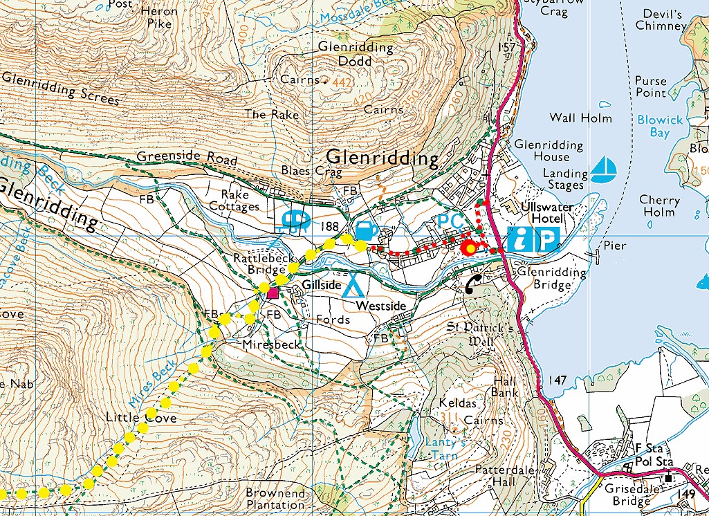
kilka informacji na poczatek, jako ze dla mnie nie bylo zbyt jasne gdzie sie kierowac spod visitor centre:
ja zostawilam samochod na parkingu przy visitor centre (sklepik, toaleta), platny £7 za caly dzien (bilet mozna kupic w visitor centre jesli nie ma sie drobnych do maszyny)
jednak po malych zwiadach okazalo sie ze ulica znajdujaca sie zaraz kolo visitor centre oferuje mnostwo miejsc do zaparkowania, za darmo, co wiecej parkujac wlasnie tam- skrocicie sobie spacer do poczatku szlaku. mam na mysli ulice ktora zaznaczylam na mapce na czerwono. na zolto - tedy idzie sie do poczatku szlaku na helvellyn.
z parking przy visitor centre wyjsc wyjsciem kolo drewnianej szopki do ulicy I skrecic w lewo. minac pub 'walkers rest'. niebawem dochodzi sie do rozwidlenia drog (przy lawce), skrecic w lewo, przejsc przez most, minac kamping I kierowac sie na 'helvellyn via mires beck'. przejsc przez brame I zaraz za nia skrecic w lewo (przez strumyczek). sciezka jest dobrze widoczna I wiedzie wzdluz strumienia, w gore....
car park at the visitor centre (shop, free toilet) is £7 per day (fee can be paid in visitor centre if you're short of change). there is a street just next to the visitor centre which offers lots of parking spaces and is free (I marked it red on the map above). marked in yellow are directions to the path up to helvellyn.
first hand info, as I believe that some other people, not just me, can struggle to find their way to the helvellyn path from the visitor centre:
leave the car park via exit next to the wooden shed. this will take you to the street (the free parking one!) turn left. pass the 'walkers rest' pub. soon the crossroads is reached (at the bench). take left. pass the bridge, pass the campsite and follow signposts for 'helvellyn via mires beck'. go thru the gate and just after the gate take sharp left (over the stream) and follow a well defined rocky path along the stream...

poczatek sciezki, juz po przejsciu bramki. patrzac spowrotem w strone glenridding.
the path (after crossing the gate), looking back towards glenridding
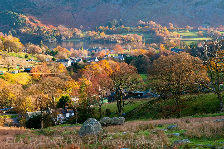
glenridding

birkhouse moor

glenridding common - ullswater -hart crag

od wysokosci mniej wiecej 670m zaczely sie zimowe scenerie
at about 670m the scenery changed from warm-autumn to frosty winter

catstye cam

bleaberry crag
..a ja wciaz sie zastanawiam czy na pewno mam isc przez striding edge :) to mniej wiecej tutaj musialabym odbic gdybym zdecydowala sie na inne podejscie. no ale raz kozie smierc, poszlam dalej na bleaberry crag I striding edge
.. and I am still wondering whether to tackle striding edge :) if I decided against it, bleaberry crag is the place where the other path starts.. well, you live only once :) I went on to bleaberry crag and further to the striding edge :)

helvellyn chowa sie! / hiding!

fajna zmarznieta trawa na bleaberry crag
nicely frozen grass on bleaberry crag

patrzac spowrotem w strone / looking back to bleaberry crag

pierwsze widoki na / first views towards striding edge

helvellyn, red tarn, catstye cam

high spying how
(w oddali) to tu zaczyna sie striding edge. tam spotkalam kolejna pare ktora miala ten sam dylemat co ja. z tym ze oni zdecydowali sie zawrocic.
(far) here the striding edge starts. also there I met another couple having the same tough decision time. but eventually they decided to turn back.

bleaberry crag z / from high spying how

high spying how zaczynamy / here we go!

red tarn & catstye cam

pierwszy krok na striding edge I juz wiedzialam ze bedzie dobrze. pieknie porzadnie zamarzniety snieg, zero poslizgu, doskonala przyczepnosc. serce rosnie, czuje sie w zywiole!
after making the first step on striding edge I already knew this was going to be good! perfectly and properly frozen snow, great grip. my heart grew, it felt like heaven! definitely my kind of thing :)


striding edge

gran nie byla ani zbyt waska (choc byly miejsca gdzie na szerokosc miescila sie tylko jedna stopa) ani zbyt stroma. cala gran udalo mi sie przejsc 'czubkiem' bez potrzeby schodzenia na 'bezpieczniejsze' sciezki nieco ponizej.
the edge wasn't too narrow (only couple of moments where the slabs and rocks were no more than a my-foot-wide) and it wasn't too airy. I managed to walk full edge length on the very top, no need to use bypass paths.


jakies 2/3 grani juz za mna, nadciagaja ludzie :)
after walking 2/3 edge length i looked back and noticed some more people appeared

striding edge


helvellyn

na samym koncu striding edge znajduje sie stromy komin ktorym trzeba zeskrabac sie na dol, ale nie powinno to stanowic problem - nie jest totalnie pionowy I jest bardzo duzo uchwytow.
potem juz tylko dosc krotka wspinaczka po dosc stromym zboczu I zaskakujaco szybko znalazlam sie na szczycie
at the very end of striding edge there is a chimney which one has to scramble down. no problem here, the chimney isn't totally vertical and there's lots of holds. after that there is another scramble up the steep slope of helvellyn and I reached the summit in no time

red tarn & catstye cam

helvellyn szczyt / summit

catstye cam & helvellyn


red tarn, striding edge & helvellyn


moja droga powrotna, przez swirral edge
my way back down, via swirral edge

sniezno-mrozowe grzybki na szczycie helvellyn
snowy-frosty mushrooms, helvellyn summit

catstye cam

striding edge

red tarn

swirral edge
schodzilo sie dosc nieprzyjemnie. zdaje sie ze wiekszosc ludzi tedy wlasnie wchodzila do gory, snieg byl rozchlapany I mokry, bardzo slisko.
way down the swirral edge was rather unpleasant. seemed like most people chose this route to walk up, snow as wet, iced, very slippery.

przy pierwszej okazji zeszlam na 'bezpieczniejsza' sciezke ponizej samej grani
I went down to the bypass path as soon as I spotted it

patrzac spowrotem na helvellyn I swirral edge.
looking back to helvellyn and swirral edge

swirral edge

slonce zachodzace za striding edge
sun setting behind striding edge

postanowilam wykorzystac na maksa ostatnie promienie slonca wiec schodzilam ta sama droga - tedy jeszcze przez kolejne 40 min szlam w sloncu, wystarczajaco dlugo zebym zdazyla wyschnac :)
I decided to enjoy the sunshine as long as I could and therefore made my route back down the same as I went up. this ridge walk gave me another 40 mins of bright sunshine, enough to dry up :)


